
Over the past decade, augmented reality (AR) technology has advanced significantly, reaching mainstream recognition through applications like Pokémon Go. Today, the same technological principles are being utilized in unexpected ways, including disaster recovery efforts. At Arizona State University’s (ASU) Los Angeles campus, students are leveraging 3D modeling techniques to document the damage caused by recent wildfires in Los Angeles County, offering support to victims and contributing to long-term recovery efforts.

The Impact of Los Angeles Wildfires
The Eaton and Palisades fires have left widespread devastation in their wake. Thousands of families lost their homes, personal belongings, and places of worship, while some even suffered the loss of loved ones. In response to the tragedy, ASU’s Narrative and Emerging Media program launched an initiative aimed at preserving a visual record of the disaster. By creating 3D models of affected areas, the project helps victims with insurance claims and provides a valuable resource for understanding the full extent of the damage.
According to Ashley Buschhorn, a graduate student at ASU leading the project, the primary goal is twofold: first, to assist wildfire survivors in filing accurate insurance claims, and second, to provide a comprehensive public record of the destruction’s impact on communities.
Also Read: Google’s Genie 2 Transforms Single Images Into Playable 3D Worlds
How the Technology Works
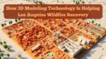
The project employs a sophisticated imaging technique known as “Gaussian splatting,” a process that enables the creation of realistic 3D scenes. Using a specialized four-camera rig, students capture high-resolution images from multiple angles. The collected data is processed using software such as Polycam and Snaniverse, the latter of which is owned by Niantic Inc., the company behind Pokémon Go.
These tools help stitch together thousands of images, transforming them into fully interactive 3D environments. This allows displaced residents to virtually revisit their properties and identify lost possessions, which can be crucial for filing insurance claims. Additionally, the data is being used by city planners and first responders to assess structural damage and inform future emergency preparedness strategies.
Personal Motivations Behind the Project
Professor Nonny de la Peña, a pioneer in virtual and augmented reality, leads the initiative. Her personal experience with fire loss has significantly shaped the project’s objectives. Two years ago, her home studio was destroyed after an electric bicycle battery exploded. The fire consumed everything, from computers and storage drives to sentimental items like family photos. However, a few remnants survived, including a charred love letter and a signed card from Mark Hamill, which read, “The Force will be with you always.”
Her insurance company initially denied compensation for a sofa lost in the fire, but because she had a photograph of the remains, she was able to prove its existence and secure coverage. This experience reinforced her belief in the importance of detailed visual records for insurance claims and emotional closure.
Also Read: James Cameron and Meta Collaborate to Revolutionize 3D Mixed Reality
Fieldwork in Disaster Zones
Before evacuation orders were lifted, de la Peña and her team ventured into fire-damaged neighborhoods, equipped with hazmat suits and press passes. Navigating through hazardous debris, they carefully documented intersections, landmarks, homes, and personal belongings left behind.
The fieldwork was challenging, particularly for de la Peña, as many of her personal friends were among the fire’s victims. One of them, her son’s longtime cello teacher, lost his home entirely. Another was a close friend who had hosted her baby shower. The process of recording these losses was deeply emotional, yet necessary to support those affected.
Training the Next Generation of Disaster Responders
ASU students involved in the project receive rigorous training in 3D modeling techniques, best practices for field documentation, and data processing. Graduate student Ashley Buschhorn now leads workshops for new students, ensuring that each member of the team understands how to operate the specialized camera equipment and software.
During a recent training session, Buschhorn emphasized the importance of capturing images from every possible angle, likening it to painting an object where complete coverage is required for accuracy. She also warned students to be mindful of file sizes, as 3D modeling requires large amounts of data.
Also Read: Top 5 Best and Cheapest 3D Printer Pens among Doodlers
Future Applications and Expanding the Initiative
The success of this project has opened the door for further applications of 3D modeling in disaster response. Researchers are exploring ways to integrate the technology into urban planning, search and rescue operations, and climate change mitigation efforts. Given the increasing frequency and severity of wildfires in California and beyond, initiatives like ASU’s are becoming more crucial than ever.
As technology continues to evolve, the ability to create detailed digital reconstructions of disaster zones could become a standard tool for emergency responders and government agencies. By capturing the devastation in such a precise manner, researchers and policymakers can better understand the long-term effects of wildfires and develop more effective recovery strategies.
This initiative represents a groundbreaking fusion of technology and humanitarian aid, highlighting how advancements in augmented reality and 3D modeling can serve critical roles beyond entertainment. By helping survivors reclaim their losses and communities rebuild, projects like ASU’s are shaping the future of disaster recovery efforts.
Also Read: Vivo Unveils Robotics Lab and Mixed Reality Headset at Boao Forum 2025
Frequently Asked Questions (FAQs)
1. What is 3D modeling technology, and how does it help with wildfire recovery? 3D modeling technology creates realistic digital representations of environments, which can help document wildfire damage, support insurance claims, and inform rebuilding efforts.
2. What is Gaussian splatting, and why is it used in this project? Gaussian splatting is an advanced imaging technique that helps create highly detailed 3D models by capturing multiple angles of an object or scene, making it ideal for disaster documentation.
3. How does this project assist wildfire survivors? The 3D models provide visual records that can be used for insurance claims, allowing survivors to prove the extent of their losses and receive proper compensation.
4. Who is leading the ASU wildfire documentation initiative? The project is led by Nonny de la Peña, a professor at ASU’s Narrative and Emerging Media program, along with graduate student Ashley Buschhorn.
5. What companies provide the software for the 3D modeling? The project utilizes Polycam and Snaniverse, the latter of which is owned by Niantic Inc., the creators of Pokémon Go.
6. Why is capturing images from multiple angles important for 3D modeling? Capturing images from all angles ensures that the software can accurately reconstruct surfaces, textures, and lighting conditions to create a true-to-life 3D model.
7. How does this project benefit future disaster response efforts? The technology can be used for emergency planning, structural damage assessments, and search and rescue operations in future disasters.
8. What personal experiences motivated Nonny de la Peña to start this initiative? After losing her home studio in a fire, de la Peña struggled with insurance claims and realized the importance of having photographic records for proving losses.
9. Are students trained in safety precautions before documenting disaster zones? Yes, students receive training in field safety, including how to navigate hazardous environments and handle sensitive data responsibly.
10. How can this technology be applied to other disasters? 3D modeling can be used in earthquakes, floods, and hurricanes to document damage, support relief efforts, and assist in rebuilding affected communities.