
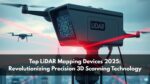
In 2025, LiDAR mapping devices stand at the center of a technological revolution that’s redefining how we see, measure, and interact with the physical world. From autonomous vehicles to environmental research, construction, and urban planning, LiDAR (Light Detection and Ranging) has evolved far beyond its early days in topographical mapping.

Unlike traditional imaging systems, LiDAR uses precise laser pulses to measure distances and create highly detailed 3D models of environments. As computing power, miniaturization, and data processing capabilities have improved, LiDAR mapping devices have become faster, smaller, and more affordable — making them essential tools for engineers, researchers, and industries relying on spatial intelligence.
This article explores the best LiDAR mapping devices in 2025, their features, applications, and how they’re driving next-generation solutions in smart cities, autonomous mobility, and environmental monitoring.
What Is LiDAR Mapping?
LiDAR mapping is a remote sensing technique that measures the time it takes for laser pulses to reflect back from surfaces. These reflections are used to generate highly accurate 3D representations of the scanned environment.
Each LiDAR system typically includes:
- A laser emitter: to send thousands of light pulses per second.
- A receiver or sensor: to capture returning signals.
- A GPS and IMU unit: for precise location and motion tracking.
- Processing software: to convert point clouds into detailed 3D maps.
The result is a high-resolution spatial dataset that allows professionals to measure terrain, detect structures, and analyze features with centimeter-level precision.
Also Read: ARKit vs ARCore: What Should You Use?
The Evolution of LiDAR Mapping Devices
LiDAR technology has evolved dramatically over the past decade. Earlier systems were bulky, expensive, and limited to aircraft or vehicle-mounted setups. Today, compact and portable LiDAR mapping devices are accessible to industries and individual users alike.
1. From Terrestrial to Mobile
Traditional terrestrial LiDAR scanners were primarily used for surveying fixed locations. However, with the advent of mobile and drone-based LiDAR, mapping vast areas has become faster and more efficient.
2. AI and Cloud Integration
AI algorithms now enhance LiDAR data interpretation by filtering noise, identifying objects, and classifying materials automatically. Cloud-based software allows teams to collaborate remotely, accessing real-time processed LiDAR data from anywhere.
3. Affordable Miniaturization
Recent advances in semiconductor and photonics have reduced LiDAR sensor size and cost, leading to widespread integration in drones, vehicles, and handheld scanners.
Top LiDAR Mapping Devices in 2025
Here’s a deep dive into the leading LiDAR mapping devices of 2025 that are setting new industry benchmarks in accuracy, range, and usability.
1. Velodyne Alpha Prime
Velodyne’s Alpha Prime continues to dominate the market with its unmatched long-range detection and multi-environment adaptability. Designed for autonomous vehicles and smart city infrastructure, it captures up to 4.8 million points per second.
Key Features:
- 245-meter range
- 360° horizontal field of view
- High-speed data streaming
- Ideal for automotive and industrial robotics
Use Case: Long-distance mapping for highways, logistics, and traffic monitoring.
2. Leica RTC360
Leica’s RTC360 is a preferred choice among professionals for high-precision terrestrial scanning. Its advanced HDR imaging and auto-registration capabilities reduce post-processing time significantly.
Key Features:
- 2 million points per second capture rate
- Lightweight (5.8 kg) for field use
- Cloud-to-cloud registration
- Integration with Leica Cyclone software
Use Case: Architectural surveys, cultural heritage documentation, and infrastructure inspection.
3. DJI Zenmuse L2
DJI’s Zenmuse L2 LiDAR system combines high-altitude drone scanning with real-time 3D mapping. Its integration with DJI’s ecosystem makes it accessible for professionals in agriculture, forestry, and topography.
Key Features:
- 450-meter detection range
- Supports real-time colorized point clouds
- Compact design for drone compatibility
- Exceptional ground penetration capability
Use Case: Forestry management, agricultural analysis, and large-scale terrain mapping.
Also Read: Wi-Fi Mapping Technology Can Map Individuals Inside Buildings
4. RIEGL VZ-600i
RIEGL is known for its industrial-grade LiDAR scanners, and the VZ-600i exemplifies this with robust performance and ultra-high accuracy.
Key Features:
- Dual-axis laser scanner
- Real-time waveform processing
- Operates under extreme weather conditions
- Automatic target recognition
Use Case: Mining, railways, and energy infrastructure scanning.
5. GeoSLAM ZEB Horizon
The ZEB Horizon is one of the most versatile mobile LiDAR mapping systems, allowing users to walk, drive, or fly while collecting data. Its SLAM (Simultaneous Localization and Mapping) technology delivers reliable scans even in GPS-denied environments.
Key Features:
- Portable, handheld design
- 100-meter range
- 3D data capture in real-time
- Works indoors and outdoors
Use Case: Facility management, interior scanning, and tunnel mapping.
How LiDAR Mapping Devices Work
LiDAR mapping devices operate by sending out laser pulses that bounce off surfaces. The system records the time of flight (ToF) for each pulse, which determines distance. Thousands of such measurements form a point cloud — a dense collection of spatial data points representing the scanned surface.
Processing software then interprets this point cloud into digital terrain models, 3D structures, and detailed maps. Advanced systems now use machine learning algorithms to segment and classify data automatically.
Also Read: 7 Real-World AR Case Studies from 2025
Major Applications of LiDAR Mapping Devices
LiDAR mapping is now integral to multiple industries. Below are some of the major applications reshaping the modern world:
1. Autonomous Vehicles
LiDAR sensors form the “eyes” of self-driving cars, enabling them to detect obstacles, pedestrians, and road features with high precision.
2. Urban Planning and Smart Cities
Urban planners use LiDAR data to analyze infrastructure, design sustainable layouts, and assess environmental impacts for smart city development.
3. Environmental and Forestry Studies
LiDAR helps researchers monitor vegetation density, biomass, and topographical changes in forests, aiding conservation efforts and ecological research.
4. Construction and Engineering
Engineers utilize LiDAR for building information modeling (BIM), site inspection, and progress tracking — reducing human error and ensuring project accuracy.
5. Archaeology and Cultural Heritage
LiDAR scanning reveals hidden ruins beneath dense vegetation, offering archaeologists a non-invasive method to explore historical sites.
Challenges in LiDAR Mapping
While LiDAR mapping devices offer groundbreaking advantages, they’re not without limitations:
- Cost: High-end devices remain expensive despite growing competition.
- Weather Sensitivity: Heavy rain or fog can disrupt laser reflections.
- Data Complexity: Processing massive point cloud datasets demands robust computing resources.
- Battery Life: Portable and drone-based LiDAR systems still face endurance limitations.
Ongoing research aims to address these issues through AI-assisted noise filtering, edge computing, and hybrid sensor fusion.
The Future of LiDAR Mapping Devices
Looking ahead, LiDAR mapping devices are poised to become even more compact, intelligent, and interconnected. Here’s what’s on the horizon:
- Integration with AI and AR: Future devices will combine real-time AI processing with augmented reality visualization for on-site decision-making.
- Quantum LiDAR Systems: Researchers are developing quantum-enhanced LiDAR that promises sub-millimeter accuracy in adverse weather conditions.
- 5G and Cloud Connectivity: High-speed networks will allow for instant transfer and processing of LiDAR data on global scales.
- Lower Costs and Consumer Accessibility: As LiDAR components become cheaper, personal mapping and hobbyist scanning may soon become mainstream.
LiDAR Mapping Devices Market Outlook 2025
According to global reports, the LiDAR mapping market is projected to surpass $6 billion by 2027, with rapid adoption in transportation, construction, and geospatial analytics. Companies investing in LiDAR R&D are focusing on multi-sensor fusion, combining radar, vision, and LiDAR for holistic data insights.
Emerging startups are also launching open-source LiDAR platforms, democratizing access to mapping data and fueling innovation across industries.
Also Read: Yellow Heart on Snapchat: Decoding the Emoji Language
Expert Opinion: Why LiDAR Still Matters
Despite advances in radar and vision-based sensing, experts agree that LiDAR remains the gold standard for depth accuracy. As AI and robotics expand, the need for precise 3D perception will only grow.
LiDAR’s ability to map environments in all dimensions makes it essential not just for navigation, but for understanding how machines interact with space — from autonomous drones to industrial robots.
Conclusion
LiDAR mapping devices have come a long way from niche scientific instruments to powerful, accessible tools driving the digital transformation of our world. Their precision, reliability, and versatility make them indispensable in fields ranging from autonomous transportation to environmental conservation.
As technology evolves through 2025 and beyond, expect LiDAR to become even smarter, faster, and more affordable — illuminating the path toward a more connected and intelligent planet.
Frequently Asked Questions (FAQs)
1. What is a LiDAR mapping device?
A LiDAR mapping device is a system that uses laser light to measure distances and generate 3D models of environments.
2. How does LiDAR mapping work?
LiDAR sends laser pulses to measure the time they take to return, creating a detailed 3D point cloud of the area scanned.
3. What industries use LiDAR mapping devices?
Industries like construction, urban planning, forestry, archaeology, and autonomous vehicle development heavily rely on LiDAR technology.
4. Are LiDAR mapping devices expensive?
Professional-grade devices can cost thousands of dollars, though prices are dropping as technology advances.
5. Can LiDAR work in the dark?
Yes, LiDAR operates independently of ambient light, making it ideal for night operations or dark environments.
6. What is the difference between LiDAR and radar?
LiDAR uses laser light for high-resolution mapping, while radar uses radio waves and provides lower detail.
7. Can drones carry LiDAR mapping devices?
Yes, many drones are equipped with lightweight LiDAR scanners for aerial surveys and mapping.
8. What software is used with LiDAR mapping devices?
Popular software includes Leica Cyclone, Pix4D, and CloudCompare for processing and visualizing LiDAR data.
9. What’s the future of LiDAR mapping?
The future includes AI integration, quantum LiDAR development, and cost-efficient sensors for mass-market applications.
10. Is LiDAR safe to use?
Yes, LiDAR devices use low-power lasers that are safe for human eyes and environmentally non-invasive.